The Great Himalaya
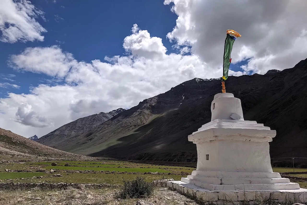 Buddhist chorten (stupa) in the Pin Valley, near the village of Mudh, Spiti
At last they entered a world within a world—a valley of leagues where the high hills were fashioned of a mere rubble and refuse from off the knees of the mountains...“Surely the Gods live here!” said Kim.
—Rudyard Kipling, Kim
Walking to Tibet –well, kind of. I planned to hike to Spiti, a part of Greater Tibet marooned in India. The hike would traverse the Great Himalaya, the definitive mountain range separating the Aryan (Indian) peoples to the south, from the Tibetan peoples to the north.
The Great Himalaya Range runs more than two thousand kilometers; from the northern border of Kashmir in the west, to the mountains on the border of Sikkim and Bhutan in the east. I planned to traverse the western end, from the Bhaba Valley of Kinnaur, to the Pin Valley of Spiti, via the prosaically named Pin-Bhaba Pass.
The south of the Great Himalaya was in the full throws of the Indian monsoon, wrecking havoc throughout the valleys. In Kinnaur that month, a landslide had caused a chain reaction of enormous falling boulders, causing mass destruction, taking out a bridge and killing nine people. However, the north of the Great Himalaya was a high-altitude desert; the high peaks created a rain-shadow, leaving the region with mostly dry, sunny, and peaceful days.
I cycled from Shimla along the Hindustan-Tibet Road, a spectacular route, built by the British in the 19th Century, carved from the rock of the impossibly steep cliffs, way above the Sutlej River below. My turn-off was to the small village and trail-head at Kafnoo.
The hike was short, at just under fifty km, but the elevation shot up sharply to 5000m, so I planned a couple of short days to acclimatise. The first day I enjoyed a blissful hike, into the hills, and onto Kara Lake. Arriving to fairly heavy rain, I happily found a cave-overhang where I could pitch my tent.
The next day was another short day, so I slept in late and dawdled around camp until late morning. Then, after navigating a series of thigh deep glacial streams, I hiked up to the base camp at Pushtirang where I met a small group of Pahari (Indian hill peoples): Yeshoo and his two friends, were from the nearby town of Rampur, and they were also hiking over the pass the next day.
Yeshoo and his troop were sharing one tent between them, they carried a pressure cooker, and with it an eight kilogram gas cylinder with attached stove. Obviously weight wasn't a concern, they even carried a kilogram of salt! The burden however, was not equally distributed, with Yeshoo taking the brunt. They said they were leaving at first light, so considering the bad weather, I thought it prudent to join them.
I set my alarm for 4.15am, and slept until midnight, then in rolled the heaviest storm we'd seen. It lasted for hours, with the corners of my tent slowly filling with water. None of us slept much during the downpour, and we woke, bleary-eyed, in the dark and now drizzling rain.
As the first light came, the mountains were still under a thick fog. So we waited, in anticipation, hoping the wind would blow, and the light would pierce the clouds. Then as we held our gaze above in hope, directly above our path up the mountainside, the clouds parted and the light shone down. It was our sign, now was time to move.
Yeshoo and I set the pace, powering up the ill-defined route, through loose rocks and scree. This section was the most dangerous, the ground was unstable and with the bad weather, landslides could happen at any moment. Nothing came our way, but we heard several series of explosive sounds across the way, as rocks tumbled and crashed.
The rain and fog returned, reducing visibility to just a few yards. I was on the heels of a speedy Yeshoo, who was gunning up a steep stream, and scrambling through the dirt in the pouring rain. Pretty certain he'd taken us off route, I checked the GPS, and sure enough, this muddy scramble was way off.
Back on track, we slowly crossed the numerous glaciers; each step was tentative –with fresh snow and no footsteps to follow, we were mindful of hidden crevasses. Continuing up, we eventually saw the Tibetan prayer flags at the top. When we reached the pass, the weather was so bad, we took just a moment for a picture. We had made it, to the crest of the Great Himalaya, yet this was no place for men to linger.
The way down looked daunting. The initial track, was a slither of footprints in ice, on the precipice of a sheer drop. I was rather apprehensive, especially with a heavy bag, and was glad to have the camaraderie of the others. The method was to put the weight on your heels, and dig the rear-ledges into the snow –yet my shoes had no ledges. To counter, I kept pushing my balance and my bare hands into the ice, consequently my fingers were quickly frozen solid.
As we continued, the altitude lessened, along with the nerves. We even managed to slide down the snow on our backsides –it was the quickest and most fun way down, controlling the momentum with a hiking stick. In the late afternoon we got to the windy, yet dry and sunny campsite of Bara Boulder, and took our well earned rest for the night.
The next day, after saying farewell to Yeshoo et al., I walked toward the first Spittian village of Mudh (rhymes with could). I came across my first chorten (stupa) and grazing dzo (half-breed yaks). I greeted the locals with a cheerful 'julley' and the women were unabashed. I crossed the Pin River towards the village, where the buildings were in the classic Tibetan style; white-washed, with mud roofs, and all facing the sun. I was back in civilisation, yet I had walked from one world to a entirely different and enchanting new world.
- ← Previous
Storms and Slugs - Next →
The Hidden Kingdom